Canada
I've lived near Canada for most of my life, but I never really paid much attention to it. Recently, however, I've begun participating in a pub quiz at DeVere's Irish pub in Sacramento, and my lack of knowledge of Canada began to really matter.
So, I tried to memorize the Canadian geography.
Here's the scheme I came up with to hammer it into my memory.
First, here is a map of Canada:
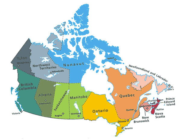
You might notice that it is broken up into nice chunks. The big chunks on top are called territories. The lower chunks are called Provinces.
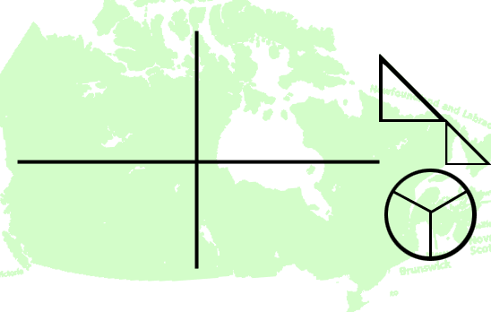
The whole country can be divided into six parts: a 2x2 table, a pie chart and a pair of triangles.
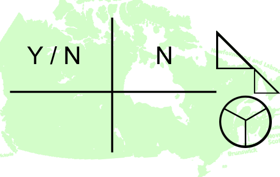
The top of the 2x2 table holds two columns. On the left is a Y/N, as in a yes/no question. The answer to that question is N, shown in the upper right half.
The Y stands for Yukon Territory. The N stands for Northwest Territory. It's kind of odd that the territory called "Northwest" isn't the most northwest territory. Yukon territory is the most northwest. The Northwest territory seems to be lying.
Maybe the Northwest territory is the one that should be called Yukon, because when when you address it, you say "You con!".
The answer to the Y/N question is another Territory, called Nunavut. The Nunavut territory is pretty new, so you probably don't remember the name from when you played RISK. You'll have to memorize the name of that one, the only advice I have for you is that the name starts with an "N" and is consonant/vowel/consonant/vowel/consonant/vowel/consonant. You might also envision the image of a Catholic nun looking at her cup of tea. Nunavut.

The second row of Canada holds the provinces. The rectangular sections could be labelled BAS and MOQ.
Seattle, at the far right side, and just below the US border, plays loud music. That part of Canada can hear the BASS. The letters BAS stand for British Columbia, Alberta, Saskatechwan.
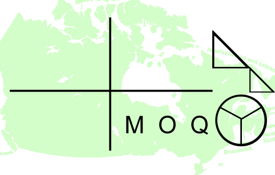
The next letters are MOQ.
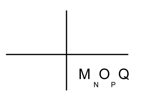
This doesn't spell anything, but hopefully you can remember that the letters are seperated by one letter in the alphabet: MnOpQ. The M is Manitoba and the O is for Ontario. The Q is probably the easiest to remember, standing for Quebec.
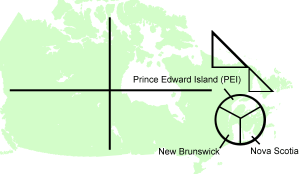
Next, there is a circle of small provinces all together, separated by water. Consider those as a circle divided by lines like a pie. The top part is actually a PEI piece, which stands for Prince Edward Island. The lower left section is New Brunswick. Brunswick is a name which you hopefully associate with bowling equipment. Note that this circle also looks like a bowling ball. The final third of this circle is Nova Scotia. A nova is a round thing also. Nova Scotia is latin for "New Scotland". This is the part of the circle which is closest to Scotland.
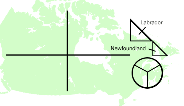
The connected triangles are the final province of Canada. See how they look like two Ls? The top part is Labrador, which is the name of a dog which finds things and retrieves them. What did this dog find? New Found Land.

That's it for the territories and provinces. Don't forget where everything is! There is a quiz on this tomorrow.
